|
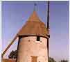
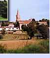
The Lauragais spreads out over a surface of 2400 km2, from the gates of Toulouse to Castelnaudary, from Verfeil-Puylaurens to Auterive, Belpech and Fanjeaux. Frontiers that still lack precision, and on which historians and geographers haven't yet managed to agree on. The link with the map underneath gives a wider vision of the zone, around a central point being the Canal du Midi and encompassing a territory spreading over four departments (Aude, Ariège, Haute Garonne and Tarn).
|